Story
Reading Shamokin’s 1884 Bird’s-Eye
An explicitly dated bird’s-eye view pictures Shamokin as a dense nineteenth-century city while reminding modern viewers that pictorial perspective is not survey geometry.
Historically established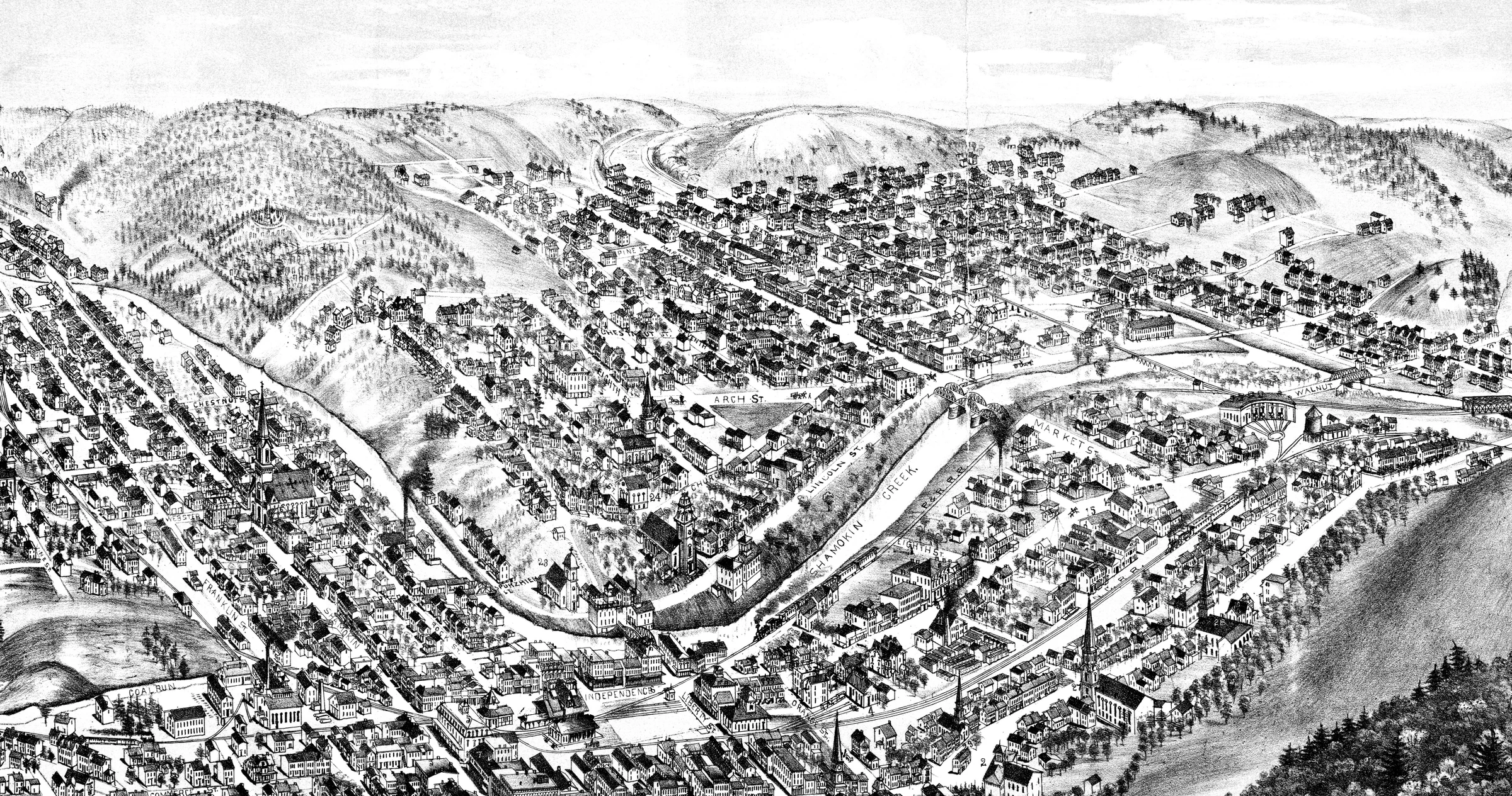
A City Pictured in 1884
The printed title dates the bird’s-eye view to 1884. Its central illustration presents a built-up borough of streets, roofs, industrial buildings, waterways, bridges, rail corridors, churches, and surrounding hills.
A Picture, Not a Survey
Bird’s-eye views were composed to make an entire city legible at once. Buildings, distances, and sightlines are therefore illustrative: the image can reveal urban form and visual emphasis, but it cannot establish modern parcel boundaries, exact routes, camera position, or survey-grade coordinates.
Reading Change Across Three Views
The earlier coal-basin view, the panoramic inset dated 1873, and the 1884 bird’s-eye can be read as three separate visual moments. Together they show a settlement becoming more densely built, while each image keeps the limits of its own format and point of view rather than forming a seamless geographic reconstruction.